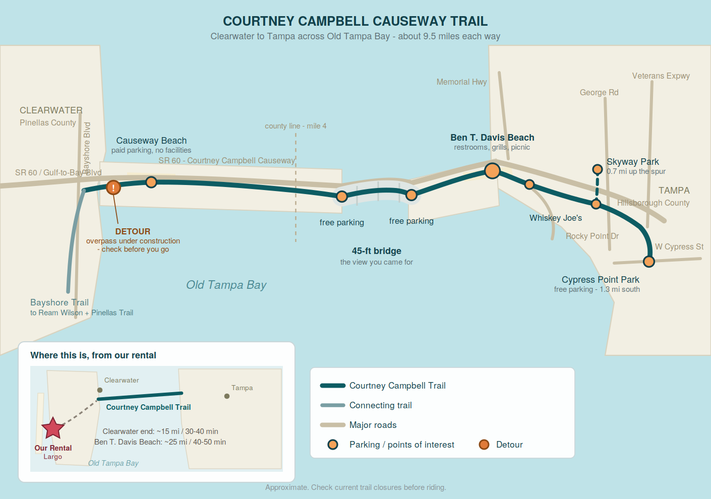
Nine and a half miles of car-free path straight across open water, with a 45-foot bridge in the middle that gives you Tampa Bay on both sides at once. If you ride one thing while you’re here that isn’t on Pinellas soil, make it this.
Why We Love This Trail
There is no other ride like it on this coast.
The Courtney Campbell Trail runs the entire southern edge of the causeway that carries State Road 60 across Old Tampa Bay, linking two counties and two cities. It’s completely separated from the roadway by barriers and wide medians, with its own bike bridges. And unlike almost any other trail in Florida, the water isn’t a view you catch occasionally — it’s on both sides of you for miles.
The centerpiece is the 45-foot bridge near the middle. The climb is the only real elevation on the whole route, the descent on the far side is a genuine reward, and the view from the top takes in the full sweep of the bay with Tampa’s skyline in the distance.
Both counties have landscaped the medians well, and while road noise is a constant depending on which way the wind blows, the ride is smooth, almost perfectly straight, and flat apart from that one hill.
⚠️ Before You Go: Active Construction
A section at the Clearwater end has been closed for construction. Crews are building a pedestrian and bicycle overpass over Gulf-to-Bay Boulevard just east of Bayshore Boulevard, which will finally connect the Bayshore Trail directly to the Courtney Campbell Trail. Construction has been running through 2025 and 2026 with completion targeted for late 2026.
The detour, when the closure is in place, runs from the Bayshore Trail east along the Gulf-to-Bay Blvd sidewalk to the Nova Southeastern University entrance, then crosses SR 60 to rejoin the trail at Courtney Campbell Causeway Beach.
Check the current status before you load the car. When the overpass is finished this end of the trail will be dramatically better — but until then, starting from the Tampa side avoids the problem entirely.
At a Glance
| 📏 Length | About 9.5 miles each way |
| 🛣️ Surface | Paved, 8–12 feet wide |
| ⛰️ Difficulty | Easy — flat except the 45-ft bridge |
| 🌉 Bridges | Two — one low, one tall |
| 🚧 Separation | Barriers and wide medians throughout |
| 💵 Cost | Free to ride; parking varies |
| 🌳 Shade | Essentially none |
| 🐕 Dogs | Welcome on leash |
| 📍 Endpoints | Bayshore Blvd, Clearwater ↔ W Cypress St, Tampa |
| 🚗 From Our Rental | Roughly 20 miles — a day trip, not a quick spin |
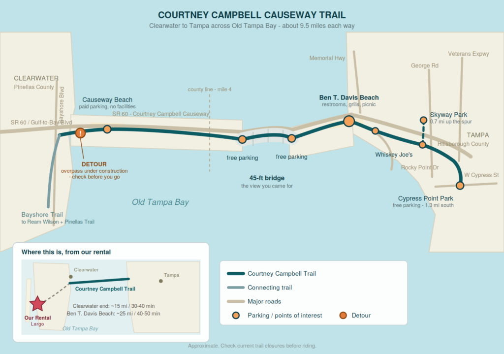
Trail Map
Where to Park
Parking along the causeway is at a premium, especially on weekends. Here’s the honest ranking.
🥇 Ben T. Davis Beach — Best All-Round
7740 W Courtney Campbell Cswy, Tampa
The largest lot on the causeway, with picnic tables, grills, and — critically — the only public restroom most riders report finding anywhere on the trail. Paid parking at lot meters, and reasonable: one rider paid about $9 for five hours. Plan your ride around this being your facilities stop.
🥈 Free Lots Either Side of the Tall Bridge
There’s free parking in the middle of the causeway on both sides of the main bridge, including a lot designated as a sunset viewing spot. Fewer spaces and no facilities, but it puts you right at the best part of the trail if you only have an hour.
🥉 Cypress Point Park, Tampa
Free parking at the eastern end, off Cypress Street. About 1.3 miles south of the trail via the Skyway Park Trail. Technically where the trail begins.
Skyway Park
3901 George Rd, Tampa — more free parking, 0.7 miles north of the trail junction along the Skyway Park Trail.
Courtney Campbell Causeway Beach (Clearwater side)
Paid parking and no other amenities — no restrooms, no shade. Usable, but Ben T. Davis is better in every respect except distance from us.
Three Ways to Ride It
🌉 The Bridge Loop — ~4 miles round trip
Park free at one of the mid-causeway lots, ride over the bridge, and come back. This is the concentrated version: all of the view, none of the mileage, and about an hour start to finish. If you have kids or someone in the group who isn’t a rider, this is the one.
🏖️ Beach to Bridge and Back — ~10 miles round trip
Start at Ben T. Davis Beach. Ride west across the tall bridge, continue toward the Pinellas side as far as you feel like, then turn around. You get the bridge in both directions, restrooms and grills at the start and finish, and swimming at the end if you brought a towel.
Lunch: Whiskey Joe’s (7720 W Courtney Campbell Cswy) sits right next door to Ben T. Davis Beach — a casual, sprawling beach-bar setup with tables scattered across the sand and water access. There are bike racks, which matters, because car parking there is valet only. Service runs on island time; the view makes up for it.
A little further east at Rocky Point there’s a cluster of waterfront restaurants including the Rusty Pelican (2425 N Rocky Point Dr) if you want something considerably more upscale to finish the day.
🚴 The Full Crossing — ~19 miles round trip
Clearwater to Tampa and back, or one way with a shuttle. It’s flat and fast, and a fit rider does it comfortably in a morning. Just respect the wind — see below.
Know Before You Go
💨 Wind Is the Real Variable
This is the one thing that separates a great day from a miserable one. You’re riding across open water with nothing to break the breeze, and a stiff headwind on the return leg can turn a pleasant nine miles into a grind. Check the forecast, and if there’s real wind, ride into it on the way out so it pushes you home.
☀️ There Is No Shade. Anywhere.
Riders describe the trail as completely unshaded, and they’re not exaggerating. Sunscreen, a hat under the helmet, long sleeves if you burn, and more water than you think. In summer this is a dawn ride or not a ride at all.
🚻 Plan Your Restroom Stop
Ben T. Davis Beach is the reliable one. Don’t assume you’ll find another.
🚶 It Gets Busy
The trail is wide, but it’s popular with cyclists, walkers, runners, skaters, and dog walkers all at once. Call your passes and give people room.
🔊 Road Noise
Being straightforward: SR 60 is right there, and depending on wind direction you’ll hear it the whole way. This is a spectacular ride, not a peaceful one. If you want quiet, the Pinellas Trail north of Clearwater is the better choice.
A Bit of History
The causeway was built between 1927 and 1934, spearheaded by Ben T. Davis, who owned a local dredging company, and it originally carried his name — the Davis Causeway.
In 1948 it was renamed for Courtney W. Campbell, later a U.S. Representative, in recognition of his work sponsoring repairs and beautification while serving on the Florida State Road Board. Davis’s family fought the renaming and lost. His name survives at the beach near the Tampa end — which, given that it’s the best stop on the whole trail, is arguably the better memorial.
Connecting Trails
- Bayshore Trail — at the Clearwater end, linking to the Ream Wilson Clearwater Trail and from there the Pinellas Trail and the wider 75-mile loop
- Skyway Park Trail — near the Tampa end, running 0.7 miles north to Skyway Park and 1.3 miles south to Cypress Point Park
- Upper Tampa Bay Trail — reachable from the Tampa side for riders wanting to link two of the region’s major trails in one day
👉 Our Pinellas Trail guide | Our Memorial Causeway guide | Back to our biking guide
Getting There from Our Vacation Rental
From: 1731 Clearwater Harbor Dr, Largo, FL
To the Clearwater end (Bayshore Blvd / SR 60): roughly 15 miles, 30–40 minutes. Check the construction status first.
To Ben T. Davis Beach (Tampa side, best facilities): roughly 25 miles, 40–50 minutes across the causeway. Longer drive, better trailhead, and no detour to worry about.
📱 GPS directions to Ben T. Davis Beach
This one is a planned outing rather than a spontaneous one. Pack water, sunscreen, and a towel, and give it most of a day.
Staying with us and thinking about the causeway? Ask us about current trail conditions before you go — we keep an eye on the construction.